Today’s report was written by a guest blogger, Alex Johnson, who also happens to be my husband.
26 August 2020
In the late afternoon last Saturday, the wind shifted and we got our first breaths of fresh air all week. We even saw actual clouds and blue sky for the first time in 5 days! Also fortunately, the thunderstorms predicted over the weekend bypassed us, and since then the weather has been much more cooperative for the firefighters: our marine layer came back (which at least helps in the lower elevations near the coast), the winds have been relatively calm, and the temperatures have been more moderate.
We no longer have ash and burnt vegetation falling continuously from the sky. Only sporadic ash fall now. However this morning the smoke came back, so our air quality is terrible again.
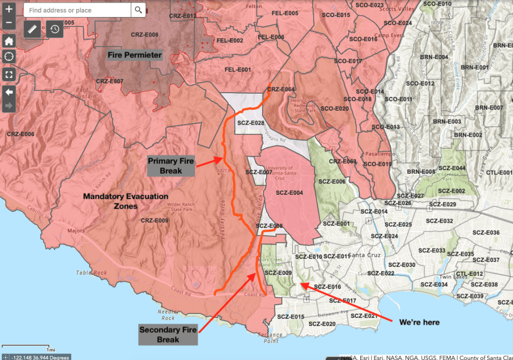
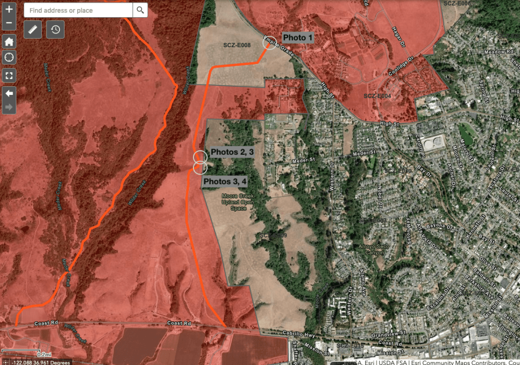
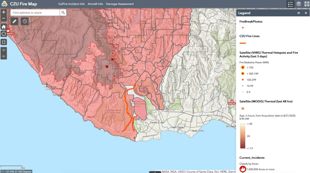
Finally, the fire crews were able to construct fire lines over the weekend to protect our area of town. Two lines were constructed. The primary line runs from Wilder Ranch at Highway 1 up to the far upper reaches of the UCSC campus (at Twin Gates) and then down to Highway 9 south of Felton. A secondary line runs through private land between the Moore Creek Preserve and Wilder Ranch up to Empire Grade Road just south of the west entrance to the UCSC campus.

Yesterday I took a hike to have a look at the secondary break. Here’s what I saw:
In the areas I took a look at, they used bulldozers to widen existing ranch roads (dirt), to about 50 feet in width. While digitizing the lines on the map, I noticed that the firefighters appeared to do this where ever possible. In other areas it was evident they had to cut through heavy timber/brush.
Needless to say, with these fire breaks in and the improved weather, we are feeling very much relieved and more secure. We still have our bags packed and are ready to leave, however.
Also because I’m a mapping geek I created my own web maps, pulling together data from various sources so I can keep track of what’s happening. It includes these photos, the fire breaks, evacuation areas, and other info I’ve found useful. The maps above came from those web maps, so here’s a link if you’d like to explore:
The situation remains fluid, but at least the weather is cooperating for now. The breaks that have been established are protecting both the city of Santa Cruz and the UC Santa Cruz campus. Smoke in the air remains a problem, and air quality has ranged from not-too-bad to don’t-breathe-if-you-have-to-go-outside. Still, at least we aren’t likely to have to evacuate any time soon.


Thanks for this information, we were wondering exactly where the fire breaks were! We’re evacuated from east of Felton, came down here to my brother’s house a mile from the River Fire – thankfully after three days of non-stop helitack flights overhead, it has retreated. Looking forward to coming home, feeling blessed – so many have lost their homes …
I’m glad you made it out okay! From the latest CalFire updates it sounds like Felton is well protected, although it will be a while before residents can return. And yes, it is very sad that so many people have lost homes.